Longleaf Trace Trail
![]()
| SUMMARY | ||||
| Location | Trail Type | Difficulty | Length | Fee |
| Hattesburg to Prentiss, Miss. | Paved Railroad Bed | Beginner | 41 miles | Free |
Longleaf Trace Map - a link to map on longleaftrace.org. Visit their site for more info.
![]()
DESCRIPTION: The Longleaf Trace follows and is built on the old railroad bed that runs from Hattesburg to Prentiss, Mississippi. It goes through the town of Sumrall and the small farm towns of Bassfield and Carson. The paved gently rolling trail is ideal for bicycling, skating, and all the family activities associated with many rail-to-trail projects. There is an equestrian trail which parallels the trail for 26 miles from Carson to Epley Station.
WHO RIDES HERE: Local folks and people who travel hundreds of miles to bicycle the trail or to ride horses on the equestrian trail. It is suitable for families because of the level trail with great views of the Southern Mississippi landscape.
FACILITIES: The map shows ten parking areas for bikers, walkers, runners, and such. There are seven parking areas for horse riders and their special requirements. Many of the parking and rest stops have restroom facilities.
![]()
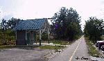
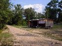
SOME PHOTOS OF THE TRAIL: Click the Thumbnail to load the photos.
 |
 |
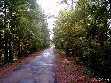 |
| Trail Access Point | A Reststop on the trail | Typical Trail |
![]()
MORE INFORMATION:
![]()
Last updated: 05/19/01
Author: Aaron and Alabama Mountain Biking